Duffus is a large coastal parish, with
village, of the Laigh of Moray, extending to nearly 10,000
acres north-east of Elgin, and Hopeman is a large planned
village, with harbour, while Roseisle is a purely rural area
now, with a huge planted forest to the west. The small town
of Burghead is also in Duffus Parish, but, with the nearby
village of Cummingston, is more conveniently dealt with
separately. There is a coastline of 7 miles, sandy to the
west, but elsewhere rocky, with cliffs and caves, formerly a
great haunt of smugglers. Much of the parish used to be under
water, partly from an arm of the sea stretching inland
eastwards from the Roseisle area, partly from the great Loch
of Spynie. A mighty sand-blow, of the Culbin variety, cut off
the arm of the sea in the late 17th century, and subsequent
reclamation, with the draining of the loch by the Spynie
Canal, leaves this now a most fertile expanse. The name
DUFFUS means "Black Water".
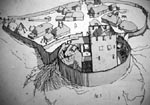
Duffus rose to prominence because of its great castle, built
in the reign of David II, Bruce's son, on what would then be
an island in the waterlogged area, a green eminence, largely
artificial, with surrounding moat. The first motte-and-bailey
castle was of timber harled with clay. We read of Sir
Reginald Cheyne, who married the heiress in 1286, petitioning
the all-conquering Edward of England in 1305, for permission
to fell 200 oak trees "to build his manor of
Duffus" - galling indeed to have had to win English
permission to fell his own trees. This stronghold was
replaced in due course by a stone keep and surrounding
curtain-walling, the remains of which dominate the flat lands
today as a noted landmark, and are in the care of the
Department of the Environment. The property was granted to
the progenitor of the great Moray or Murray family, the
famous Freskin, in 1150, but passed, through marriage of
heiresses, first to the Cheynes and then to the Sutherlands,
in 1350 - these Sutherlands however being of the same Moray
stock. The tenth Sutherland laird was created first Lord
Duffus in 1651, for aiding King Charles the Second, and the
line survived until 1843, when the title fell dormant for
lack of accepted heirs. Long before that, however, Duffus
Castle had ceased to be occupied.
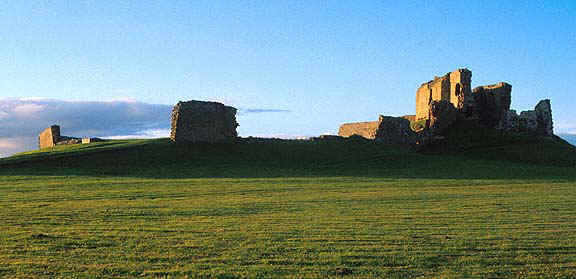
It does not appear to have featured largely in history,
despite its size and strength, covering no less than 8 acres
within its 25 feet-wide ditch, with outer and inner baileys,
drawbridges, and ten-foot-thick walling, honeycombed with
mural chambers. This stone castle was built well on in the
14th century, and it is interesting to note that the keep,
although wide, was not vaulted as was usual but was provided
with timber floors - a testimony to the great oaks which grew
in this tree-growing Laigh of Moray, to make such timbering
possible. A small chapel, or oratory, was contrived in the
thickness of the walling. Large sections of the masonry have
sagged or collapsed because of the sandy soil of the hillock,
but it is notable how the mortar has not given way, and
substantial lengths of walling lean at odd angles. Much of
the curtain-walling remains, and the whole gives an excellent
impression of the lay-out of a typical motte-and-bailey
castle, but little altered.
Duffus village, old church and later mansion, lie over a mile
north, on slightly rising ground. The village, once called
New Duffus, is pleasantly situated, and fairly compact,
although it has increased largely in recent years with modern
housing. Here, at the roadside, is the present parish church,
dating from 1868, quite large and handsome, with a tall spire
and fairly recent graveyard. There are still some old village
houses. This is not the site of the original church, which
stood half a mile to the east, near Duffus House, and is now
a roofless but well preserved ruin, known as St. Peter's
Kirk, with its ancient kirkyard surrounding. It is a pleasant
place, amongst old trees, well cared for. The present walls
are mainly 18th century, but with much older work included,
and a most excellent early 16th century porch, complete with
groined vaulted roof.
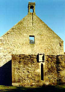
Sutherland Vault on back of St. Peter's Kirk
There is also a barrel-vaulted
Sutherland of Duffus crypt, or aisle , to the west, which was
the basement of the original tower. Here is some heraldry and
a Sutherland grave dated 1626. There is a holy-water stoup
just inside the main doorway, and a grave slab with an early
cavalry cross on the floor of the church, with many other
slabs used as paving. On the outside east gable is inserted a
Latin tablet dated 1616. There are two outside forestairs to
what had been a timber-floored loft, and an empty belfry.
High on the south front is a stone cherub built in, and on
the north walling also part of a very ancient gravestone
showing a two-handed sword, plus other built-in fragments. In
the kirkyard rises the Duffus or St. Peter's Cross, a typical
medieval Mercat Cross, a tall slender column on a plinth,
similar to that at Michael Kirk, Gordonstoun, near by. The
former holy well lay at the roadside just north, but is now
barely discernable.
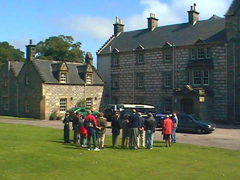
Duffus House
Duffus House, now a boarding-house of Gordonstoun School, is
a large, whitewashed mansion standing in its grounds to the
south, mainly Victorian but with very early 18th century
nucleus and some good painted heraldry in the vestibule. It
belonged to the Baronet family of Dunbar of Northfield (* see
note below), and used to be called Thunderton; their
town-house in Elgin still survives, although converted into a
hotel. (* my note: Duffus House was always known as Duffus
House and had been built by the Sutherlands of Duffus when
the castle was no longer habitable). Thunderton House was the
townhouse of these same Sutherlands of Duffus. All of the
Sutherland of Duffus property was mortgaged to the Dunbars to
get cash to invest in the Darien colony venture. When the
colony failed, the Sutherland Lord of Duffus could not repay
his loan and Dunbar took possession of his property!)
A mile west of Duffus Village is the farming estate of Inverugie, which once belonged to the Keith Marischal family,
who named the property after their great lands in Buchan.
There was a small castle or fortalice near the present rather
pleasant mansion.

Camus' Stone
To the south, in the park, is a large, rough weatherworn and cracked boulder, six-and-a-half feet
high, known as the Camus Stone, and alleged, like other
stones so called, to mark the scene of the death of an
evidently very fierce Danish invading leader named Camus. It
was formerly at Kaim of Duffus, to the south.
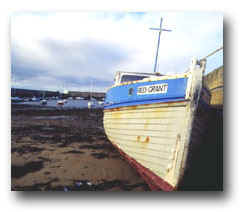
Hopeman Harbour
The village, or small town, of Hopeman, lies a mile to the
north, on a gentle ridge sloping down to the sea. It was
founded as a fishing community only in 1805, and was much
enlarged and the harbour improved by Admiral Duff of Drummuir
who bought the lands in 1837. It has a rather bare aspect,
lacking trees in a countryside so rich in timber, but
compact, its streets laid out at right angles. Quite large,
with a population of over 1,000, it lays itself out to
attract holiday-makers. But its two dozen
seine-net-fishing-boats still constitute its basic industry -
although 120 boats once fished from here. Its harbour is also
much used by pleasure-craft, but unfortunately suffers from
sand-silting. There is an old ice-house, with the usual
vaulted roof, for the storing of fish. At the top of the
little town is the 'quad sacre' church, which was the Duffus
Free Church originally, of 1854, with a tall clock tower and
noted landmark added in 1923 as a gift from an Elgin
distiller who worshipped here. The church is large, with a
gallery around three sides, but no graveyard. The village has
many stone cottages of traditional fisher style, considerable
modern housing, a caravan site, playing fields, other
sporting facilities including a 9 hole golf course, and a
Tourist Association, all above a rocky coast with one or two
beaches. The renowned Covesea Caves, one with Pictish roof
carvings, are usually approached from Hopeman, and the
cliff-walk is very scenic.
Roseisle, as its name suggests, was once an island in the
great formerly water-logged area of Duffus and Drainie
parishes. A ridge of hill there rises to 280 feet - no great
altitude, but notable indeed in an area where the height
above sea-level averages around 20 feet. To the west of this
hill the vast planted Roseisle Forest extends along the
coastal plain for nearly five miles, with the parish boundary
more than half way. For the rest, there are only farms, and
the tiny cross-roads hamlet of College of Roseisle. This
ambitiously named little group of cottages stands on the site
of what was once a quite important community of the Celtic
Church, planted here in the early days of Christianity in
Scotland. Cummingstown, a village of the parish north of
Roseisle and west of Hopeman, is dealt with under Burghead. A
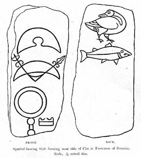
Pictish symbol-stone from Easteron of Roseisle, depicting
goose and fish sculpturing, was taken to the Museum of
Antiquities, Edinburgh in 1932."
